Brian Kennett
Amateur Chef, Foodie Extraordinaire and Traveller
Lumayag Sandbar Review: Mabini, Bohol
Lumayag Sandbar Review: Bohol’s famed tourist spots include the island’s Chocolate Hills, Tarsiers, Blood Compacts, centuries-old churches, pristine beaches like Alona Beach, diving, snorkelling, and some amazingly opulent beachfront hotels. But what if I told you that Bohol has yet more to offer with the likes of Lumayag Sandbar, Mabini, Bohol.
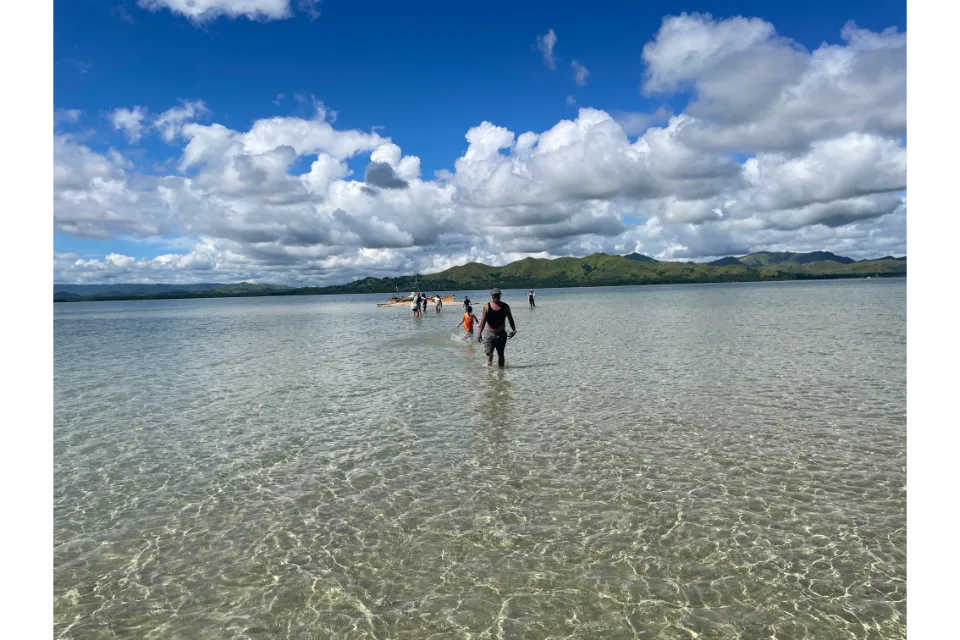
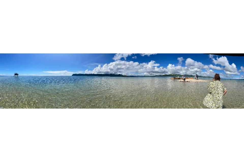
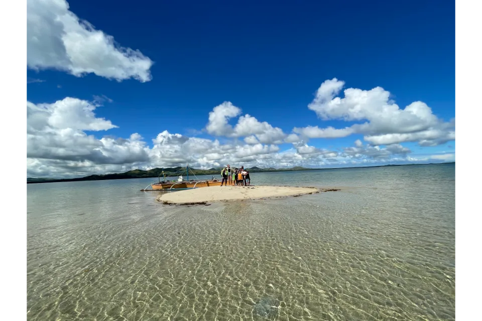
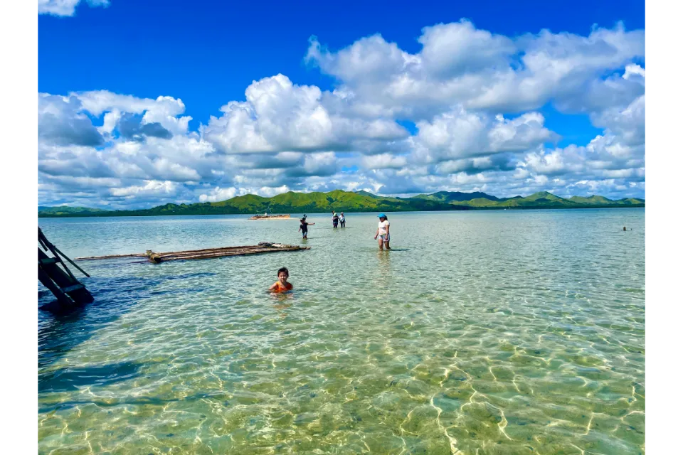
Lumayag Sandbar is a beautiful atoll island that is only visible at low tide. No, that is an understatement. It is absolutely stunning and so very unique. We were literally in the middle of a topaz, aquamarine sea, standing in ankle-deep water. We were the only people there. Yes, it’s unique, and boy does it take your breath away. I literally had a Jesus moment as it felt like we were literally walking on water in the middle of the sea, it’s quite an experience.
Lumayag Sandbar Review: Contents
Lakeside Camp and Bohol Campsite: new to Mabini
Full review of Lakeside Camp and Bohol Campsite Review: HERE.
Located in Baybayon, Mabini, Bohol, the Philippines, Lumayag Sandbar is 4km from the Mabini barangay proper and is visible during low tide and submerged during high tide. We went sort of mid-high and low tide, as we had to wait a while for the boat to be able to come into shore and pick us up. The low tide was too shallow for the boat to come in. We rented a private fishing boat for 10 of us. It seems there are no official tours of any description.
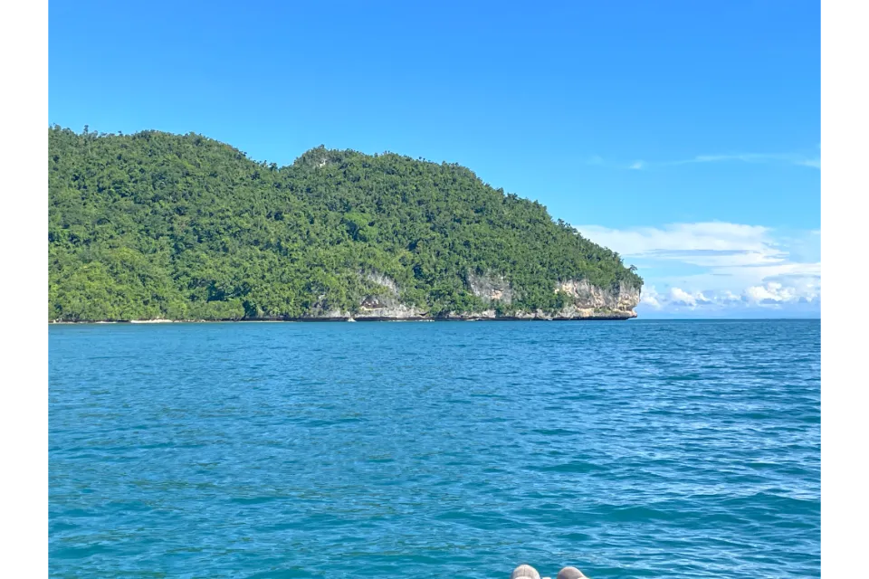
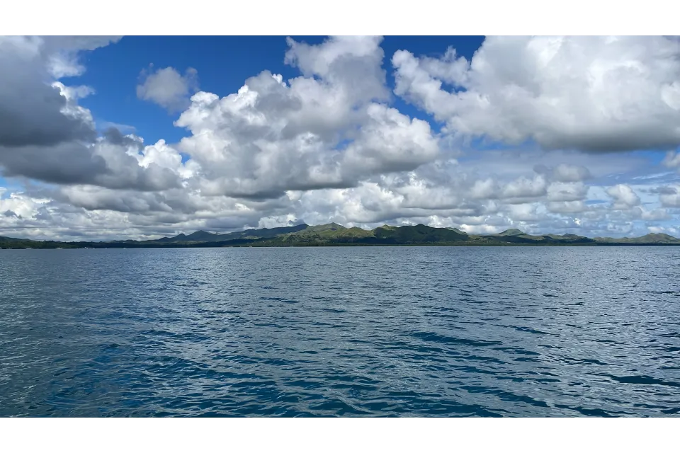
Lumayag Sandbar is a hidden gem that is slowly gaining popularity among tourists, including us this trip. The sandbar is situated in the middle of the Camotes Sea and can only be accessed by boat. It is a perfect spot for swimming, snorkelling, and onward island hopping. But, to caveat, it is tough to get to. This is a drive of about 3-4 hours from Bohol’s capital City of Tagbilaran, to Mabini a faraway barangay on the island of Bohol. Plus the it’s all aboard a non-organized tourist vessel. But surely my traveling friends that’s the allure, the allure of adventure.
You could actually do a few things as an itinerary;
- Perhaps Whale Shark diving and snorkeling at Lila,
- Relax on Alona Beach, Panglao Island,
- Chocolate Hills including ATV and Danao Adventure Park,
- Stop over at Anda at White Sandy Beach,
- An early rise and drive to Mabini to get onboard your boat and catch that tide,
- As you travel make sure you pig-out on the incredible Filipino cuisine on offer,
- On the way back you could visit the many waterfalls, see the Tarsier, or the fireflies at Loboc,
- And, maybe if the timing is right, catch the Tagbilaran Filipino Festivals of Sandugo.
Where is Lumayag Sandbar?
Map of Bohol – Map of the Philippines
One of the main attractions of Lumayag Sandbar is its crystal-clear water which ranges from turquoise to aquamarine. The water is so clear that you can see the various types of fish and corals that inhabit the area. The sandbar itself is made up of fine white sand in between almost gravel-like sand. I suppose that is needed to stop it being washed away by the tides? This is not the talcum powder white sand of Alona Beach, believe me.
Lumayag Sandbar is an ideal destination for those who want to get away from the hustle and bustle of the city, and people. The sandbar is so very peaceful and secluded, making it the perfect spot for a relaxing getaway for a few hours. Visitors can take a dip in the cool waters, sunbathe on the sandbar, or take a walk and explore. It’s quite the strangest feeling to be in the middle of the sea in waters not even up to your knees.
Snorkelling is also a popular activity at Lumayag Sandbar. The sandbar’s surrounding waters are home to a diverse array of marine life, including colorful fish, corals, sea turtles, and the protected giant clams. Visitors should buy snorkelling gear before leaving Tagbilaran, as there is nowhere in Mabini to buy or rent.
The Lumayag Sandbar is also an excellent spot for island hopping. Visitors can take a boat tour to nearby islands, such as Poro Island and Pacijan Island, and explore the local culture and traditions. There is no accommodation nearby, likely the closest accommodation is Anda, an adjoining barangay to Mabini. Anda is stunning, and known for the super-long White Sandy Beach, which is also the actual name of the beach. There is a lot of accommodation at Anda, and we have stayed at a few such as;
Map of Anda Bohol – Map of the Philippines
White Sand Beach, Anda, Bohol, the Philippines
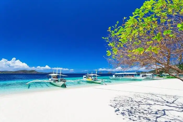
Anda, in the Philippines, has several beautiful beaches with white sand. Anda, which can be found in the province of Bohol in the Philippines, is renowned for its breathtaking beaches, which have azure waters and white sand shorelines. These beaches are consistently ranked among the greatest in the nation and draw in tens of thousands of visitors each and every year. I concur with this completely, as my Wife originates from here.
This is my second home, and what an exquisite front garden that is… Then add to the equation Alona Beach, on Panglao, likely where you’ll be landing from overseas and you are in white beach heaven. Alona Beach is in Panglao, where the International Airport is. Grab your case and 20 minutes later you’ll have your toes in the sand of Alona Beach with a cold Pilsen in your hand.
Here are four must-do things when visiting White Sand Beach, Anda Bohol;
Quinale Beach
Quinale Beach is widely regarded as one of Anda’s most picturesque and tranquil beaches. This extensive expanse of white sand is bordered on both sides by palm trees and water that is so pure that swimming and snorkeling are both enjoyable activities here. In addition, the beach is well-known for its breathtaking sunsets, which serve as the ideal backdrop for a leisurely stroll or a meal for two in the evening.
Bulak Beach
Another well-liked place to visit in Anda is Bulak Beach, which is distinguished by its powdery white sand and azure water. Those looking to get away from the throng and enjoy some peace and quiet will find this beach to be an excellent option. Swimming is highly encouraged here because of the absence of waves, and snorkeling is a popular activity thanks to the reef of coral that is located nearby.
Pool inside the Cabagnow Cave
Although I have never personally done this, it is highly recommended that you pay a visit to the exquisite Cabagnow Cave Pool in Anda. This breathtaking pool may be found inside a cave and contains water that is both turquoise and crystal clear. The scene is certainly one of a kind and absolutely gorgeous thanks to the white sandy bottom and the surrounding cliffs.
The Bacong Beach area
The Bacong Beach is a long expanse of white sand that is enclosed on all sides by coconut palms and the deepest blue water that is exceptional. This beach is a wonderful location to unwind, go swimming, and take in some rays of sunshine. In addition to that, it is well-known for having breathtaking sunsets, which makes it a favourite location for photographers and romantic couples.
In conclusion, Anda is home to some of the most stunning stretches of white sand beach in the Philippines. Anda has something to offer everyone, whether you’re wanting to relax, swim, snorkel, or simply take in the natural beauty of the area around you. You are in for a vacation on the beach that will go down in your memory forever if you go to Anda.
Anda and White Sand Beach, IS Paradise found…
Map of Anda Bohol, Map of the Philippines
What is Limadjag?
You may also hear the term, Limadjag, used by native speakers to describe the region. The old folk of the barangay would get in their little boat called a Vilos, with a single mast called a Ladjag. As this sandbar is only available during a short period of time between tides, the elderly would raise the “Ladjag” to visit. Originally known as “Ladjag,” the area’s name was changed over time to “Limadjag” because local fishermen began using the term to describe the area as a pleasant spot for fishing and picnicking. How cool is that?
Literally or figuratively, you can call this beautiful place whatever you wish, but the Lungsodaan people will always refer to it as Limadjag, a term that honours their ancestors and represents the historical fruits of their labour.
In order to gather seashells and fish, the locals sailed their Vilos to this pristine sandbar at low tide. Sometimes they would come to this picnic area to swim in the clear water, which was a welcome relief from the heat of the day. As it stands, there are a lot of rules on where people can and cannot go swimming and bathing. Fishing and the collection of live seashells are prohibited. Dynamite fishing is included in this – no surprise.
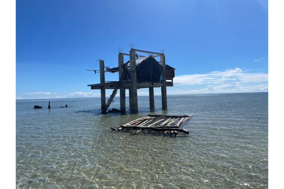
Further, it is illegal to take any coral or white sand from a public beach. The land and water around here are now protected marine habitats according to a new government decree. A sentry post, aka knackered old hut, has been set up on this little atoll island to shelter a guard who keeps an eye out for any suspicious activity. There was no one there when we visited, clearly we are not suspicious.
Our conclusions of Lumayag Sandbar, Mabini, Bohol
Overall, Lumayag Sandbar is truly a hidden gem that offers visitors a chance to experience the beauty and serenity of the Philippines. With its crystal-clear waters, white sand beaches, and lush marine diversity, it’s the perfect destination for a morning or afternoon adventure getaway. If you are planning to visit the Philippines, be sure to add Lumayag Sandbar to your itinerary.
It will be an experience you will never forget.
I certainly won’t forget our trip this year for a very long time.
How to get to Bohol?
The island of Bohol in the Philippines can be reached in a number of different ways. Both flying and using a ferry are the most popular options. There is a new International airport opened at Panglao Island, and you can bounce there from Manila or some direct flight option from China and South Korea. You can also opt for a bounce via Cebu and jump a ferry from Pier 1 straight to Tagbilaran Port.
By plane:
Both Philippine Airlines and Cebu Pacific provide multiple daily flights between Manila and Panglao International Airport
By ferry:
Oceanjet runs multiple trips per day between the cities of Cebu City and Tagbilaran City. The journey lasts for around two hours, and tickets can be bought in advance online or on the day of travel at the port. I would absolutely recommend the business class to get seats designed for the taller traveler, shall we say. It makes a major difference in the trip. Below is a link to our mates at Klook Philippines to make it easy to book.

How to get to Mabini from Tagbilaran?
To get from Tagbilaran to Mabini, you can take a bus, a jeepney, rent a scooter, a self-hire car/van or rent a private tour bus for the duration. The bus station and jeepneys are located at the Island City Mall. You can also take a tricycle or a taxi. The trip should take around 3-4 hours, depending on traffic and the mode of transportation you choose. It surely is a jaunt, so I truly recommend that you plan ahead to stay locally if doing sandbar adventures, and would highly recommend choosing Anda for that.
We’ll share two links below from Klook Philippines that give you the option of a single click to rent self-drive hire cars, or book a day tour bus from Tagbilaran to Anda. It’s so much easier with one click.
How to book a day trip to Lamayag Sandbar?
You can go to the Mabini Fishport at Baybayon. In Baybayon go straight to the Mabini Fishport and ask the person in charge if you desire to go to Lumayag Island. They will arrange a pump boat for you. Hey, it’s an adventure, right? Assume your traveler persona for this one, because it is off the beaten track with no official tours per se, but it is so beautiful she should not be missed.
Are their lifejackets and snorkels provided at Lamayag Sandbar?
No, because you are literally renting someone’s fishing boat for the day. Prior to our trip, we went to Tagbilaran City and BQ Mall to buy some life jackets, as a just-in-case for our non-swimmers. You really are in the middle of nowhere, with no support facilities of any description. Better to be on the safe side, right?
BQ Mall Tagbilaran
What are the do’s and don’ts at Lamayag Sandbar?
- The Lamayag Sandbar is an atoll, and it has a single building that served as the headquarters for the Bantay Dagat. These guys are sort of the local ‘police’ monitoring the sanctuary, and ensuring the safety of the giant clams and marine biology of the sanctuary;
- There is reception for both Globe and Smart, just a tad flaky,
- Because there is nowhere to buy groceries anywhere, you need prepare accordingly. Take water and a picnic as a bare minimum,
- You can see giant sea clams, but you can’t touch them,
- It’s possible to go swimming, but only in certain areas,
- The area has been designated as a Marine Protected Zone,
- This area is a no-fishing zone, and it is illegal to collect live seashells,
- The unlawful collection of corals, or any other municipally protected resource is a serious offense.
Whre to find more information about Lumayag Sandbar?
http://lungsodaanmb.weebly.com/mabini-limadjag–lumayag-sandbar.html
Where are other Philippines Sandbars?
Puting Balas Sandbar (Zamboanga del Sur);
- It is approximately 8 kilometers from the heart of Pagadian City, which is the capital of the province, and it is situated in the midst of Pagadian Bay. It can be found just off the shore of Pagadian City. You will need to take a motorboat from the closest port in order to get there. The distance between the port and the shore is around 5 kilometers, which is equivalent to a boat journey of 30 minutes.
- It is a bare sandbar that protrudes in the middle of Pagadian Bay. The sand is extremely fine and almost powder-like, and the water all around is immaculate and incredibly clear. There is an unending view of the seascape that can be appreciated from every angle due to the beach’s 360-degree orientation. Because this is one of those sandbars that “disappears” during low tide, you need to go there while the tides are high in order to see it.
Map of Puting Balas Sandbar – Map of the Philippines
Malalison Island
A growing beach attraction, Malalison Island is located in Barangay Culasi on Panay Island, which is located off the coast of Antique province.
- The island has a total land area of 54 hectares. In contrast to other sandbars, this one is home to a thriving fishing village, and parts of the island are characterized by undulating topography and grassy knolls. In close proximity to the ocean, the shoreline is characterized by having fine white sand and crystal clear water.
- The sandbar may be located near the easternmost point of the island. It is a slender strip of milky-white sand that stretches out into the water to create a sand bridge that connects the island’s main landmass to the sandbar. It is only seen again during the summer months, when the southeast monsoon winds keep the tides low, because it is covered up by the water at the high tide.
Map of Malalison Island – Map of the Philippines
The Manlawi Sandbar is a part of the Caramoan group of islets;
- Located in Camarines Sur, the most populous province in the Bicol region. Metro Manila is approximately 511 kilometers away from Camarines Sur by land, but it is possible to get there by taking a flight to the Virac airport, which takes only one hour. This sandbar is located on the eastern side of Lahug Island, which is the largest island in the Caramoan group of islands.
- The Manlawi Sandbar is distinguished from other sandbars in that, at its highest point, it shapes into a distinctive heart-shaped landmass. This landmass is only visible during the high tide, which normally takes place in the middle of the day when the sun’s rays are at their most intense.
- The heart-shaped sandbar, when it is visible, is approximately one kilometer wide and has powder-white sand that is quite soft to the touch. The sandbar totally disappears at the high tide, when the water is almost chest-deep in height. At several points throughout the day, the water is only up to one’s ankles deep, making it possible to walk on top of it.
Map of Manlawi Sandbar – Map of the Philippines
Little Santa Cruz Island is a strip of white sand located on the Basilan Strait, about 3.5KM south of Zamboanga City.
- It has a narrow portion leading into a denser area that has thick foliage and mangroves skimming the water’s edge. While the water is clear and inviting, swimming is strictly prohibited, and visitors are allowed to stay for only 10 minutes at a time. This is to limit the water from sunblock or lotion contamination as well as other chemicals that might potentially harm the fragile ecosystem.
- A protected marine sanctuary for sea turtles and other endemic marine creatures, Little Santa Cruz is also known for its rare pink-tinged sand that strikes quite an image against the blue, turquoise sea surrounding it. There are local tour guides astride colorful paddleboats who could accompany visitors around the island for a small fee. Nearby is the Great Santa Cruz Island, where cottages, food stalls, and shower rooms are available as well.
Map of Little Santa Cruz Island – Map of the Philippines
Palad Sandbar
Palad Sandbar is located several meters off the coast the North of Maniwaya Island, one of several islets in the municipality of Santa Cruz, Marinduque, a province in the southwestern Tagalog region bordering the Tayabas Bay;
- Early morning is the best time to visit Palad Sandbar because this is when most of the strip of sand is above water; arrive later and most of it would be submerged in shallow water. Visitors may still wade through the shores and enjoy the crystal clear sea surrounding it during high tide.
- The tide swallows up the Palad Sandbar by 11 AM, so plan ahead to make sure that you catch it above water while it is still at a low tide by riding a chartered motorized boat from Maniwaya Island in the early hours of the morning. Aside from missing the full strip of sandbar from appearing during the high tide, it is best to avoid the crowds that typically converge in the afternoon as well.
Map of Palad Sandbar – Map of the Philippines
Corangon Shoal
A sandbar known as Corangon Shoal may be found in the town of Tiwi, which is located in Albay, a province located around 470 kilometers distant from Metro Manila.
- Because of its circular form, which resembles an egg with the sunny side up, Corangon Shaol is also known as Egg Yolk Island. This is because the drier, whiter sand in the middle of the island appears to be the yolk. It is possible to get there from the coast of Barangay Baybay by a speedboat journey that takes about 15 minutes and consists of crushed corals and sand that is as white as a pearl.
- It is a barren island that is encircled by waters that have a hint of turquoise in them and all around it, and it provides a view of the stunning seascape and islets that are located in the surrounding area in every direction.
- The sandbar that is a half acre wide is the ideal vantage point from which to observe three of the most spectacular land formations in Albay, and they are Mount Mayon, Mount Marsaga, and Mt. Malinao. From the sandbar, one can obtain an unrestricted, panoramic view of these stratovolcanoes. This provides a one-of-a-kind vantage point from which one may snap spectacular images and create unforgettable experiences.
Map of Corangon Shoal – Map of the Philippines
Panampangan
The municipality of Sapa-sapa, which is located in Tawi-Tawi, is located on the island of Panampangan and is home to the Philippines’ longest sandbar.
- It is situated on the Celebes Sea, close to the Basibuli Shoal, and its sandbar reaches out into the water a little farther than three kilometers. When viewed from above, it creates the remarkable appearance of a delicate white sand bridge delicately extending out into the blue-green turquoise waters that surround it. The mainland, from which the sandbar extends, is characterized by the presence of verdant vegetation, coconut trees, and powdery white sand similar to that which can be seen along its shores.
- It is helpful to know that travelers who wish to spend the night here can choose from a variety of huts and cottages, especially considering how remote this location is in relation to the mainland. It takes around two hours to arrive by outrigger boat from the jumping-off point in Tawi-Tawi and less than an hour by speedboat, but the journey is well worth it because it is a rare chance to step foot on this magnificent natural beauty.
Map of Panampangan – Map of the Philippines
White Island
White Island is a horseshoe-shaped sandbar that is free of any permanent constructions, both man-made and natural and is located a little over one kilometer off the northern shore of Mambajao in Camiguin.
- The island is abandoned and has no inhabitants. There are no thatched roof huts or coconut palms swinging in the breeze here; instead, there is just a lump of pure, unadulterated white sand shimmering beneath the sun’s rays standing right in the midst of the sea. This location is one of the most popular tourist destinations in Camiguin.
- Although most of it is still above water throughout the day, the U-shaped islet’s geography is constantly moving, just like the terrain of the vast majority of sandbars, due to the movement of the tides. When the sun is not yet strong enough to cause discomfort to the skin, early in the morning is the perfect time to pay a visit. It is an excellent position to enjoy a panoramic view of two mountains, namely Mt. Hibok-Hibok and Mt. Vulcan, both of which you may visit by signing up for a tour package of Camiguin. This location is located in the province of Camiguin in the Philippines. The water is pleasant for swimming in, as well as for wading along the shore in search of fish and seagrass to observe.
Map of White Island – Map of the Philippines
Buntod Reef Marine Sanctuary and Sandbar (Masbate);
- This spectacular sandbar earns top points not only for the fine white sand and crystal clear water surrounding it but also for the ease and convenience of reaching it. Aside from being part of numerous Masbate island hopping tours, Buntod Reef Marine Sanctuary and Sandbar is roughly 1KM off the coast of Masbate island, just a 20-minute boat ride from the city center.
- Another reason it’s at the top of the list is that it is a well-maintained natural attraction. Covering almost 100 hectares of protected reef and mangrove forests, it has several low-impact facilities for tourists, such as cottages and huts for rent.
- Walking on the sandbar during the low tide leads to the mangrove sanctuary, where the water is so clear and shallow you can see the bottom. There are warm and cool parts around the water, making it a great place to swim and cool off beneath the shade of the mangroves surrounding it.
Map of Buntod Reef Marine Sanctuary and Sandbar – Map of the Philippines
What is a sandbar?
A sandbar is a sand and sediment deposit that grows naturally in relatively shallow water, like that seen at the shore or in a river or bay. Sandbars can be as tiny as a narrow strip or as wide as a big beach. Sediment is deposited in shallow water locations when the flow of water is impeded or redirected by waves and currents, leading to the formation of these features.
In places where rivers empty into the ocean, or where the tides and currents are particularly powerful, sandbars can form. Sedimentary materials like sand, mud and other sediments make up the bulk of their makeup, and they are ubiquitous in both freshwater and saltwater ecosystems.
Sandbars play a crucial role in coastal ecosystems by sheltering a diverse range of plant and animal species. And they’re crucial in keeping beaches safe from waves and erosion.


